")


Have Question?

Awesome Fresh is an agricultural aggregation, logistics, and cold chain company that is helping Africa feed itself sustainably for the long term
We are helping to build a more sustainable and inclusive agriculture and food supply chain. We are addressing:
-
The problem of continuous raw material availability for local food processors
-
Low yield and access to high quality inputs, price information
-
Market access for smallholder farmers.

Adetiloye Continental
CEO of Awesome Fresh
What We’re Doing

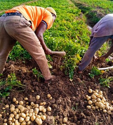
Contract
Farming
Agreement with off-takers to grow a specific crop to meet the buyers requirements.

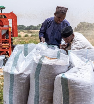
Aggregation
We are making agricultural products more accessible to our customers by gathering from multiple farmers.

Warehousing
and Storage
We provide facilities and infrastructure for the safe and proper storage of harvested crops or agricultural goods.

Cold Chain
Logistics
We provide temperature-controlled supply chain system that ensures the preservation and transportation of perishable goods.


We exist to bring innovation and organization into agriculture and ultimately
feeding 900 million people
daily by 2050.

Pure Organic Food

Healthy food for your good growth
Lorem ipsum dolor sit amet nsectetur cing elit. Suspe ndisse suscipit sagittis leo sit met entum estibu dignissim posuere cubilia durae. Leo sit met entum cubilia crae onec.
-
Harvesting
-
Growth
-
Maintenance
Our Testimonials
What They’re taking about
Lorem ipsum is simply free text dolor sit amet, consect notted adipisicing elit sed do eiusmod tempor incididunt ut labore et dolore magna aliqua.

Sarah Albert
Customer
Lorem ipsum is simply free text dolor sit amet, consect notted adipisicing elit sed do eiusmod tempor incididunt ut labore et dolore magna aliqua.

Kevin Martin
Customer
Lorem ipsum is simply free text dolor sit amet, consect notted adipisicing elit sed do eiusmod tempor incididunt ut labore et dolore magna aliqua.

Aleesha Brown
Customer
Lorem ipsum is simply free text dolor sit amet, consect notted adipisicing elit sed do eiusmod tempor incididunt ut labore et dolore magna aliqua.

Mike Hardson
Customer
-


00
farmers engaged
-
00
MT of Agricultural produce aggregated
-
00
Agricultural Products
-
00
direct and indirect jobs created
Our Latest Projects
Recently completed Projects
Get in touch now
-
-
Write Email
[email protected]
-
Visit Now
72 Yakubu Gowon Way, Zaramangada, Jos
Awesome Fresh Blog 📚